Harwood and "Stock Yards Village"
History:
The Harwood neighbourhood emerged in the 1920’s with the opening of the Harwood Presbyterian Church on Weston Road. This church and the surrounding neighbourhood are named after a Ms. Harwood, who donated the land on which Harwood Church was built. The former Harwood Church situated at 274 Weston Road, is now in use by another church of Christian denomination. Harwood has traditionally been a working class community. Many of this neighbourhood’s earliest residents were employed at the Hinds Brothers brickyard or at the Overland Car factory which were both situated on Weston Road. Harwood’s second phase of residential development took place after World War II. New home development along St. Clair Avenue West has helped to revitalize this old Toronto neighbourhood.
Overview:
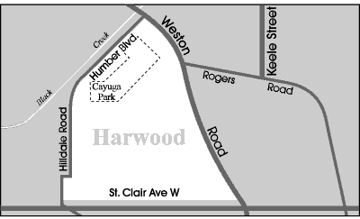
Harwood is an entry level neighbourhood that is located on the top of an escarpment overlooking the Black Creek Valley. Harwood is bordered by the Black Creek on the north, and Lavender Creek on its southern and western boundaries. These natural barriers limit access to this quiet and unassuming neighbourhood. But Wait…That was then, this is now. Stock Yards Village an open-air mall on St. Clair Avenue West has transformed this neighbourhood into a trendy urban destination for singles, couples and young families. The rows and rows of townhomes that surround Stock Yards Village are affordable for first time buyers looking to live in the City close to downtown.
Lifestyle:
Harwood residents can walk to the shopping district along Weston Road. This retail corridor features small variety stores, home improvement stores and restaurants. There are also large leather and shoe factory outlets along this route. The St. Clair Avenue West retail corridor is also brimming with convenience type stores and restaurants. “Big Box” retailers including Canadian Tire and Home Depot have recently opened in this shopping district. Stock Yards Village outdoor mall is the most recent addition to the neighbourhood. It features many national retailers and restaurants.
Homes:
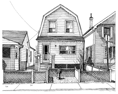
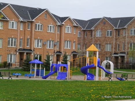
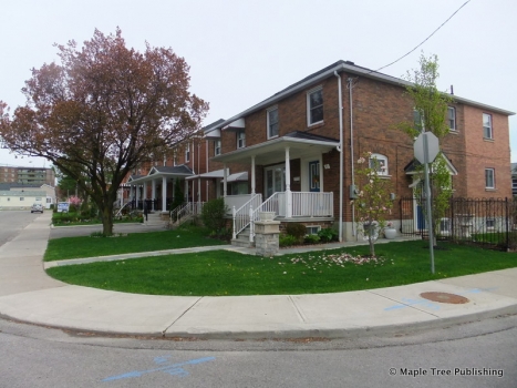
The houses in the Harwood neighbourhood were built over a very long period of time beginning in the early 1900’s and progressing until the 1960’s. These houses include many different styles of bungalows and semi-detached homes. Many of the houses on the peripheral streets bordering this neighbourhood are situated on a high plateau of land that offers excellent views of the Black Creek Valley. New home subdivisions consisting of two-level townhomes with brick fascades, and parking at the rear with built-in garages have recently been developed along St. Clair Avenue West. These are affordable options by west-end standards.
Recreation:
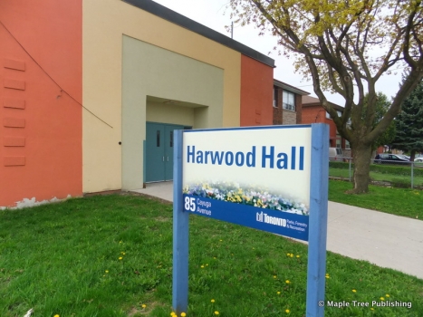
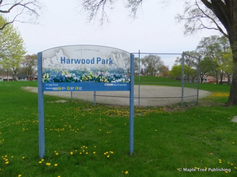
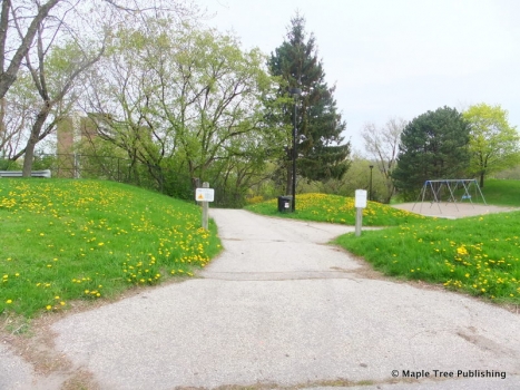
Harwood is one of the few Toronto neighbourhoods to have its own designated community Town Hall. The Harwood Hall, located at 85 Cayuga Avenue is used extensively by the Harwood Seniors Group and the York Lions Steel Band. It is also used for community meetings. Harwood Park is located across the street from the Harwood Public School. This park features a baseball diamond, a children’s playground, a walking path and little hills that are used for tobboganing. Cayuga Park, located off Cayuga Avenue, has a modern children’s playground and a walking path that leads down into the Black Creek Valley.
Transportation:
The Rockcliffe Avenue bus and the Weston Road bus connect passengers to the Runnymede and the Keele stations respectively, on the Bloor-Danforth subway line. The St. Clair Avenue West bus connects to the St. Clair West station on the Yonge-University-Spadina subway line.
St. Clair Avenue West is a major arterial roadway that guides passengers into the downtown core. From Black Creek Drive, motorists are approximately ten minutes to Highway 400 and 401.
Commute Times
* All commuting times provided are approximate times only. Commute times may increase or decrease depending on where you live within the neighbourhood and the time of day i.e rush hour versus off hour commutes. Time estimates to public transit are based on walking distance or bus line connection whichever is quicker. All other commute times on the chart above are based on drive times.
School Guide
No Records Found
Sorry, no records were found. Please adjust your search criteria and try again.
Google Map Not Loaded
Sorry, unable to load Google Maps API.
Toronto School Resources

Editor’s Note. BEFORE MOVING INTO, BUYING OR RENTING A HOME, PLEASE CONTACT THE SCHOOL YOU ARE CONSIDERING BY PHONE to ensure your home is within the designated boundaries and that your child is age appropriate. WE CANNOT BE HELD RESPONSIBLE FOR ANY MISINFORMATION REGARDING SCHOOL ENROLLMENT SO DO NOT ASSUME that your child can automatically attend a specific school or specialized program until you have official confirmation from that school. Please visit the school board web sites for more information.
