Southdown
Overview:
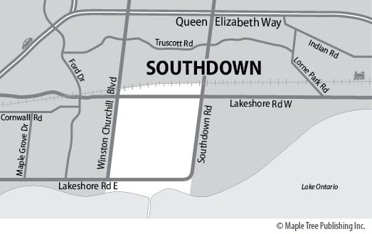
Southdown is located at the southwest corner of Mississauga. It shares a border with the Town of Oakville to the west. To the east is the Clarkson Village neighbourhood. The QEW highway is located to the north and Lake Ontario to the south. The residential area is situated north of Royal Windsor Drive with a commercial business corridor to the south. Sheridan Creek meanders through this neighbourhood spilling out to the Rattray Marsh Conservation Area situated on the shoreline of Lake Ontario. Southdown neighbourhood landmarks include the Clarkson Community Centre and Library. Clarkson Park, Ontario Racquet Club and Scooter’s Roller Palace.
Southdown Stats
Walkability:
Low
Bikeability:
Medium
Public Transit:
Low
Affordability:
Medium
Greenspace:
Medium
Medium
Legend: Low, Medium, High
Commute Times
* All commuting times provided are approximate times only. Commute times may increase or decrease depending on where you live within the neighbourhood and the time of day i.e rush hour versus off hour commutes. Time estimates to public transit are based on walking distance or bus line connection whichever is quicker. All other commute times on the chart above are based on drive times.


